|
Sept
17 , 1983 Saturday (18 mtg) From
Gonzo!s Appalachian Trail journal
According
to the Data Book for 1983, the distance to the summit of Katahdin
from Hurd Brook Lean-to was 18 miles. I could do that distance in
one day, I had proven that many times, but my goal was to get as
close to Katahdin as I could for a final ascent the following day.
Remember, after the five mile climb to the summit, there is a five
mile return to the base. I did not want to have to rush twenty-three
miles today. Besides, traveling away from Hurd Brook this morning,
I became aware of the fact that it probably would be raining this
afternoon. I just hoped I could reach either Katahdin Springs Campground,
or Daicey Pond Campground before the rain fell. I soon stepped out
onto a tote road that lead to the right toward Abol Bridge. Turning
around, I read the sign facing in the opposite direction. For those
entering the woods traveling south, was located a sign warning of
the lack of roads for the next 40 miles, and no resupply points
until the next town in Monson, Maine. I had completed the 100-mile
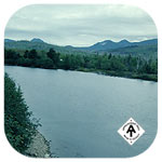
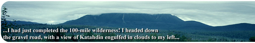
wilderness! I headed down the gravel road with a view of Katahdin
engulfed in clouds to my left. I climbed a large rock pile along
the road and photographed Katahdin as the clouds enveloped its summit
in a swirl that if viewed upside down looked like a vortex produced
in a bathroom sink as the water went down the drain.
I stopped at Abol Campground General store to pick up a few snacks
just in case I had to wait a day or so to climb Katahdin. I checked
on the price of Pop-Tarts there just to see if they were jacked-up.
They were, going for over one dollar for a pack of six. I usually
picked them up for .79 - .88 for a pack. I could feel a sense of
victory as I strolled down the road and was asked by a guy in a
truck where I had come from. I shouted out proudly, "Georgia!"
He replied, "I guess there is no need to ask if you need a
ride or not then, is there?" I said "No" and smiled
the biggest grin I think I had ever grinned.
The rain began to fall as I had four miles left to Daicey Pond Campsite.
I immersed my foot in a tributary of the Neowadnehunk Stream when
I slipped on a rock-hop crossing, and felt lost as I wandered through
an area where the trail forced me to wade through a swamp. Both
feet got soaked to match the rest of my body, which had become wet
from the rain that had begun not long before. The blazing was very
poor through the swamp, and I felt lucky that I had instinctively
chosen the correct path through the muck. It was a bad feeling to
become soaked just before getting to Katahdin, especially when the
last few days had been so clear and gorgeous.
I stopped and looked at Big Niagara Falls along Neowadnehunk Stream,
but did not take the camera out into the elements. I soon found
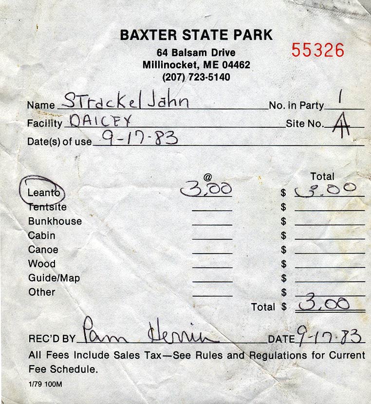
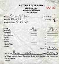
myself at Daisey Pond Campground, where I inquired of Ranger Pam
Herrin about the existence of a spot at Katahdin Stream Falls for
the night. The shelters were all taken she replied. I should not
have been surprised since it was a Saturday night. I had the option
of spending the night at the shelters nearby specifically reserved
for thru-hikers, for only one night, or going out of the park. I
chose to stay at one of the two Daisey pond shelters reserved for
thru-hikers, but spent the majority of the afternoon in the library
next to the fireplace attempting to dry my shoes, socks and other
clothing for the ascent the following morning. I had company most
of the afternoon as Richard Wansor, known as "Strider, the
Rock Hopper" showed up as well. That afternoon, we also made
reservations to spend Sunday night in the bunkhouse at Katahdin
Stream campground when we returned from our final descent from the
summit of Katahdin in victory. But for tonight, we slept in the
traditional trail shelter that we had come to know so well over
these many months, this time hoping that perhaps a moose would come
by in the open field in front of our lodgings. We went to sleep
early anticipating an early wake up to cover the two miles between
campgrounds before signing in at the rangers station and beginning
the final ascent.
Gonzo!
Appalachian Trail Journals ©1983
|