Sages Ravine


Images from
this date

What You
Missed

Progress Map

Other Images

Contact Gonzo!

Appalachian
Trail
Museum

Aug 4 , 1983 Thursday (676.8 mtg) From Gonzo!s Appalachian Trail journal

The morning started out with ominous thunder, and I knew it would not be long until the rain fell. And I was right. Soon after departing, I made a b-line to a neighbors porch overhang just off the road not far from where I had departed. I waited for the rain to quit. At least it had waited until I was awake and packed up before the rain came. The rain did not last too long, and I was off again.

Within a couple of miles I passed Limestone Springs where I found several tents still occupied, apparently waiting for the rain to let up. I wondered if any of them were thru-hikers that I had not yet met. I cruised on past because I was on a mission, a mission to put 100 miles behind me in four days time. The mountains presented me with a challenge in completing that goal. Travel over this section was very strenuous as I made my way up Lion's Head, past Bond Shelter, and then the steep climb up Bear Mountain. Although there would have been nice views at some of these places, the sky was too overcast and there were no views to be had. Upon the descent off of Bear Mountain I dropped into an area known as Sages Ravine that reminded me of some enchanted forest in medieval times as I traveled through the very lush and dark area which followed a trickling stream. While gazing at the medieval waterfall, I expected to see a maiden princess bathing in the pool below the falls - naked of course. I managed to snap a few pictures of the maiden, I mean the falls, as I stopped for a short break. Somewhere in Sages Ravine the trail passes 
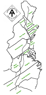
into Massachusetts. One more state down, only four more to go!

From there it was a climb up Race Mountain and then Mount Everett. While going over Everett, I joked to myself about going over Everest, the really tall mountain in Nepal. (Comment 2008: I have heard that if you add up all the ascents and descents along the A.T. that over the entire trail a hiker would have actually hiked up and down the equivalent of 14 expeditions on Mt. Everest!) The wind was blowing and the skies darkened as I passed thru this area. There was a storm brewing, but I had to keep moving. The descent off of Everett and then off of an area known as Jug End really supplied a beating to my knees. Not only was it steep, but it was the end of a long twenty-three mile day. I had just covered just under 100 miles in four days, covered Connecticut in only two and a half days, and I felt relieved when I finally arrived at Jug End Road. An additional two tenths of a mile brought me to a small picnic area with a piped spring that was flowing abundantly. The site was already occupied by a group of six young kids who were part of a solo expedition group out for thirteen days. They had no leader and were interested in my adventure, and we talked for a while. I set up my tarp on the edge of the picnic area on a level spot and drank up my fill of water from the spring. Water had been scarce all day and now it was time to re-hydrate. It sprinkled a bit before nightfall, but my tarp did a sufficient job keeping me dry. I talked with a local who stopped by the spring and found out that while I was up on Everett with the wind howling and a storm brewing, there was actually a tornado warning in the area. What the heck, I didn't know. I went to bed early as the rain continued to fall around me.

A package from Illinois was sent to Cheshire, Massachusetts today via first class (cost $3.53) (see postal receipt)

Gonzo! Appalachian Trail Journals ©1983

Next From the Beginning