 |
|
 |
|
Aug 19 , 1983 Friday (413.8 mtg) From Gonzo!s Appalachian Trail journal I became
aware this morning that the descent from Smarts Mountain, and the
descent from Mt Cube are probably what the rest of the Whites would
be like: steep and rocky, no switchbacks, just down. Or up as the
case might be. Mt. Cube's descent was worse than Smarts, being a
little longer in the steep part. As I began hiking more towards
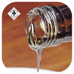
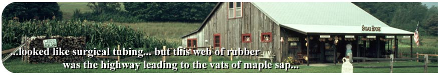
the base I ran across many rubber tubes strung from tree to tree.
It looked like surgical tubing, and it might very well have been,
but this web of rubber was the highway leading to the vats of maple
sap that the folks at the Mt Cube Maple Syrup Farm had installed
among the trees on the mountainside so that each spring they could
boil and produce Pure Maple Syrup. At route 25a, I made a detour
to the right to visit the restaurant at the farm. It is here that
the wife of the ex-governor (Mel Thompson) of the state of New Hampshire
was known to serve some of the best pancakes in the world - with
real maple syrup of course. I arrived at the Cube House before eight,
and had to wait a while before being served. As I waited, I talked
with an old gentleman whom I thought was a counselor at Camp Moosilauke,
just down the road. He asked me if I had ever considered being a
camp counselor. I responded that I would like to be, but I really
thought that only those with recreation majors were chosen for that.
He assured me that was not true, and that if I could do something
in particular, such as hiking, I could get a job. I took a name
and address and tucked it away in my pack for later use to try for
a job. I must have looked hungry as I received five rather than
the four pancakes that I ordered. The rumors were correct, these
are the best pancakes on the trail. Of course the genuine maple
syrup provided does a lot to enhance the flavor of any pancakes.
I managed to consume a piece of homemade pie and ice cream as well
after my pancake breakfast. A good stop. I took the opportunity to call mom while waiting at the post office. The record shows two calls from the Pike, NH area, one of four minutes (cost $3.51) and another we talked for thirteen minutes (cost $7.47). I estimated 7 to 8 days until Gorham, where she was to send me some guidebooks for Maine, money orders, and white liner socks. In about five days I would hopefully be on top of Mount Washington, the highest peak in New Hampshire, where I would try to make a call. (notes from Mom) I eventually received my mail, which had been sent by mom on Aug 15 and cost $7.42 first class, traveling from Illinois to New Hampshire in four days. I met
a couple of other hikers named Ray
Perry and Lysle Nikoloff at the post office while we waited
for it to open. They informed me that they intended to hike on to
Beaver Brook Shelter, while I chose to move on only to Jeffer's
Brook shelter, not far up the trail. I had already traveled 17 miles
by the time I arrived at the shelter, and moving on to the next
shelter would include climbing up Mt Moosilauke, and going down
the other side, adding another 7.6 miles and a big climb at the
end of the day. I was in no hurry, I saw the profile of Mt Moosilauke
- the altitude change involved 3000 feet practically straight up!
Welcome to the White Mountains of New Hampshire!
|
|||
